|
Route Notes:
- Minimum altitude: no minimum ... suggested 1000 feet.
- Direct Routing: 32 miles at 086
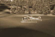
- Landing zone: water only, freezes in winter
- Hugh Smith Lake area sceneries are necessry
- Click [here] for printer-friendly
TripTic
Hugh Smith Lake Area
There are several destinations on the Hugh Smith Lake. Among these
are the Hugh Smith Ranger Station, the Hugh Smith US Forestry Service
Cabin, and a fish hatchery. The following directions will take you
within 3 miles of all of them.
From: Ketchikan International
To: Hugh Smith Lake Area locations
TreeTop VFR Directions
1. After leaving PAKT or 5KE, position over Pennock Island in
the Tongass Narrows at a heading of 110
...Pennock Island is the large island in the center of the Tongass
Narrows near the Cruise Ship docks of Ketchikan.
...Revillagigedo ("Revilla") Island is on the port wing,
Gravina Island on the starboard wing.
2. At the south end of Pennock Island, head toward Bold Island,
Set your heading at 094. Bold Island is 9 miles ahead. [5.5 minutes]
... we are going to fly over Mountain Point, a good VFR jumping
off place for the area
... the inlet to port is the Carol Inlet, a dead end reaching up
behind Ketchikan.
3. At the south end of Bold Island, set a heading for 088 for
Alava Point, the point of land 8.3 miles ahead. [5 minutes]
...After Bold Island, the inlet to port is the Thorn Arm
...the little island coming under the port wing is Round Island
...the island coming up off the starboard wing is Walker Island
4. At Alava Point set your heading at 115 for the State Islands
eight miles ahead [4.5 minutes]
...Alava Point is at the entrance of the Behm Canal, the large inlet
of water to port. This canal circles "Revilla" island.
...the tiny Twin Islands will appear about 2 miles off starboard
...the larger island to starboard is Mary Island and if you look
closely, you will be able to see the flash of the Mary Island Lighthouse,
one of three lighthouses in the Misty Fjords area.
5. Over the State Islands, set a heading of 097 for Kah Shakes
Point 3 miles ahead. [1.5 minutes]
...The inlet that comes up to port is the Boca de Quadra.
...North Quadra Mountain and South Quadra mountain guard the entrance.
...We will be turning to port into and flying up the Boca de Quadra.
6. At Kah Shakes point, turn to port to a heading of 029 toward
for Orca Point 6.2 miles ahead. You are flying up the Boca de Quadra
channel [3.5 minutes]
... Orca Point, is the last point of land you can see from here,
this is your next waypoint.
7. Orca Point comes on on your right, and this is where you
will make a right turn to 114 degrees for the tiny Kite Island in
the center of the channel, 3 miles ahead. [1.5 minutes]
... as you make the turn, the bay on your port side is Badger Bay.
...start looking for the tiny Kite Island ahead after your turn.
8. Over Kite Island, set a heading of 050 heading for Sockeye
Creek that you can see emptying from Hugh Smith Lake, just beyond.
Reduce altitude to 1200 feet to prepare for landing about 5 miles
ahead. [2 minutes]
...fly the center of the channel, it will set you up for the entrance
to Hugh Smith Lake.
9. As you come over the shore of Hugh Smith Lake a correction
to your right by 5 degrees and fly down the lake. The Hugh Smith
Cabin is toward the end of the lake on the right.
... This is a very narrow lake, stay in the center of it.
The Hugh Smith Lake Ranger Station
...located on the port shore, immedately after you come over the
lake.
The Hugh Smith US Forestry Cabin
... the cabin is located to starboard about 1/2 way down the lake,
about 3 miles after you cross the over the lake.
The Fish Hatchery
... This is located on the starboard side of the lake toward the
end of the lake.
================================================================
VFR Directions: Returning to Ketchikan
- Taxi out to the center of the lake and set your heading for
about 240 to fly down the lake and take off. Fly the lake to go
over Sockeye Creek.
- As you come over Sockeye Creek, you should set a heading for
Kite Island, 3 miles ahead at a heading of 230. [1.5 minutes]
- At Kite Island, turn to 295 heading for Orca Point about 3 miles
ahead on the left. At Orca Point you will turn left.[2 minutes]
- Round Orca Point and come to a heading of 210 which will take
you to Kah Shakes Point about 6 miles ahead [3.5 minutes]
- At Shakes Point, you can set a heading of 279 for the small
State Islands.
- At the State Islands, set a heading of 295 to Alava Point about
8 miles ahead [4.5 minutes]
- At Alava Point, set a heading of 269 for Bold Island 8.3 miles
ahead. [5 minutes]
- Over Bold Island, set a heading of 275 for Pennock Island [5.5
minutes] ... you are now in the Tongass Narrows and ATC should
be directing your destination.
Doug Linn
Charter Manager
Misty Moorings, Inc
contact@mistymoorings.com
|