|

Interactive Index
Printer-Friendly [here]
|
|
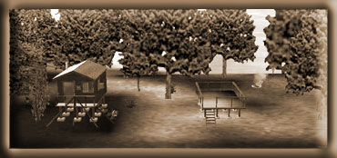
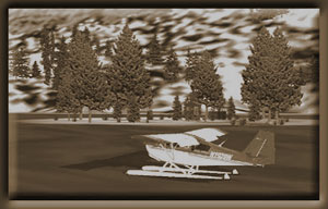
Alava
Bay Cabin
Minimum
ceiling: 2000 feetMinimum flying altitude: 1700 feet
Minimum visibility: 1 mile
Approximate distance: 20 miles
Landing Area NOT frozen in winter
Water landings year around
Direct
from Mountain Point to Cabin: 14.5 miles at 081
Direct from Cabin to Mountain Point: 14.5 miles at 260
VFR
Directions: To the Cabin
- After
leaving PAKT or 5KE, position over Pennock Island in the
Tongass Narrows at a heading of 110
- At
the south end of Pennock Island, head toward Bold Island,
Set your heading at 094. Bold Island is 9 miles ahead.
[5.4 minutes]
- At
the south end of Bold Island, set a heading for 088 for
Alava Point, the point of land 8.3 miles ahead. Begin
reducing altitude as your landing is after the next waypoint.[5
minutes]
- At
Alava Point we can set a heading direct for the Alava
Bay Cabin. Set your heading for 024, the cabin is 2.9
miles ahead [2 minutes].
- You
will see three small islands in Alava Bay just ahead.
The cabin is located on the north side of the small island
to the left, nearest the shore. Descend and make approach
based on wind and conditions.
VFR
Directions: Returning to Ketchikan
- After
leaving the cabin, set a heading for Alava Point, 204
degrees from the cabin, 2.9 miles from the cabin. [2 minutes]
- At
Alava Point, set a heading of 269 for Bold Island 8.3
miles ahead. [5 minutes]
- Over
Bold Island, set a heading of 275 for Pennock Island ...
you are now in the Tongass Narrows and ATC should be directing
your destination, 9 miles. [5.5 minutes]
Back
to Index
|
|
Bakewell
Lake Cabin 
Minimum
ceiling: 2000 feet
Minimum flying altitude: 1500 feet
Minimum visibility: 1 mile
Approximate distance: 40 miles
Direct
from Mountain Point to Cabin: 30 miles at 064
Direct from Cabin to Mountain Point: 30 miles at 244
VFR
Directions: To Bakewell Cabin
- After
leaving PAKT or 5KE, position over Pennock Island in the
Tongass Narrows at a heading of 110
- At
the south end of Pennock Island, head toward Bold Island,
Set your heading at 094. Bold Island is 9 miles ahead.
[5.5 minutes]
- At
the far end of Bold Island, set a heading for 088 for
Alava Point, this is the point of land 8.3 miles ahead.
[5 minutes]
- At
Alava Point set a heading for Nelson Point 030 which is
11.3 miles ahead up the Behm Canal. [7 minutes]
- At
Nelson Point, we set a heading of 057. You are entering
Smeaton Bay.
- At
a distance of 7 miles [about 4 minutes] , you will see
the Wilson Arm of Smeaton Bay veering off to port (left).
Reduce altitude to about 1000 feet. The Bakewell Arm is
ahead and to the right. Fly a few degrees to the right
to fly into the Bakewell Arm. Look for a small outcropping
in the water just ahead on the right about 1/4 mile. You
will be turning sharply to starboard (right) just past
this outcropping. As you make the turn, you will see Bakewell
Lake ahead of you. The cabin is almost right under you
at this point. Fly on down the lake, make a safe landing
and taxi back to the cabin.
VFR
Directions: Returning to Ketchikan
- Taxi
down Bakewell lake (about 190 degrees, South) away from
the cabin, once far enough for a takeoff, turn back toward
the cabin (heading about 009) and take off to the north.
After you lift off the lake, be ready to turn sharply
to the left as you enter the Bakewell Arm and follow it
back down into Smeaton Bay.
- Following
Smeaton Bay, fly to Nelson Point [5 minutes], which is
the point to the left of Smeaton Bay (this channel). Here
you enter the Behm Canal.
- At
Nelson Point, set a heading of 210 for Alava Point 11.3
miles ahead. [7 minutes]
- At
Alava Point, set a heading of 267 for Bold Island, 8.1
miles ahead. [5 minutes]
- Over
Bold Island, set a heading of 275 for Pennock Island (8.7
miles) ... you are now in the Tongass Narrows and ATC
should be directing your destination. [5.5 minutes]
Back
to Index
|
|
Beaver
Camp Cabin 
Minimum
ceiling: 2000 feet
Minimum flying altitude: 1700 feet
Minimum visibility: 1 mile
Approximate distance: 28 miles
Direct
from Mountain Point to Cabin: 21 miles at 022
Direct from Cabin to Mountain Point: 21 miles at 201
VFR
Directions: To the Cabins
- After
leaving PAKT or 5KE, position over Pennock Island in the
Tongass Narrows at a heading of 110
- At
the south end of Pennock Island, head toward Bold Island,
Set your heading at 094. Bold Island is 9 miles ahead.
[5.4 minutes]
- At
the south end (far end) of Bold Island, set a heading
for 068 for Cone Point, 3.7 miles ahead. [2 minutes]
- Fly
over Cone Island over Cone Point and change heading to
360 heading for Evo Point, distance 5 miles [3 minutes]
You are entering the Thorne Arm. Evo Point is the point
of land sticking out into the water from the left shore.
- At
Evo Point, set heading of 006 for Gokachin Lakes, approaching
these lakes, your altitude must be 1700 feet minimum.
[2 minutes]
- At
Gokachin Lakes, slightly correct heading for 354 and use
this heading to fly to the north end of. Ella Lake. [2
minutes] Once over Ella Lake, you may reduce your altitude
to 1200 feet.
- At
the north end of Ella Lake, make a slight heading correction
to 347 and fly through the "dip" between the
low mountain on the left and hill on the right. Follow
the grade at a safe altitude down to Manzanita Lake about
2 miles ahead.
- The
Beaver Camp Cabin is at this end (south end) of the lake
on your left. You should land as quickly as you can to
avoid a long taxi.
VFR
Directions: Returning to Ketchikan
- After
leaving the Beaver Camp Cabin, taxi north on the lake
until you have enough take off room to clear the ridge
at the south of the lake. Begin climbing to 1700 feet.
Once over Ella Lake (about 2 minutes flight time) set
a heading of 357 that will take you to the south end of
Ella Lake. [2 minutes]. Continue your climb to 1700 feet.
- Fly
3 miles to Gokachin Lakes and reset heading for 183 direct
to Cone Point (11.5 miles). [7 minutes]
- At
Cone Point, set a heading of 252 for Bold Island, 3.7
miles [2 minutes]
- Over
Bold Island, set a heading of 274 for Pennock Island [5
minutes]... you are now in the Tongass Narrows and ATC
should be directing your destination.
Back
to Index
|
|
Big
Goat Lake Cabin 
Minimum
ceiling: 2500 feet
Minimum flying altitude: 2200 feet
Minimum visibility: 3 mile
Approximate distance: 45 miles
Direct
from Mountain Point to Cabin: 35 miles at 40
Direct from Cabin to Mountain Point: 35 miles at 220
Note:
This is a more difficult cabin to approach, especially in
minimum weather conditions. You must have a ceiling of 2500
feet and you will be flying at 2200 feet altitude as you
approach the cabin. This is a "high lake" cabin,
resting at almost 1756 feet in altitude.
VFR
Directions: To the Island Cabin
- After
leaving PAKT or 5KE, position over Pennock Island in the
Tongass Narrows at a heading of 110
- At
the south end of Pennock Island, head toward Bold Island,
Set your heading at 094. Bold Island is 9 miles ahead.
[5.4 minutes]
- At
the south end of Bold Island, set a heading for 088 for
Alava Point, the point of land 8.3 miles ahead. [5 minutes]
- At
Alava Point set your heading at 017 for Smeaton Island,
9.6
miles ahead. You will fly over Rudyerd Island on this
leg. At this point, you are in the Behm Canal, a body
of water that circles the Ketchikan Area. [5.5 minutes]
- At
Smeaton Island, set your heading at 002 for Candle Island.
This is the small island at the southern tip of Winstanley
Island [2 minutes]
- Over
Winstanley Island, set a heading of 333 for the
Eddystone Islands, a small group of little islands 4.7
miles ahead [3 minutes]
- Over
the Eddystone Islands, turn to a heading of 357 to cross
over Louise Point, at the entrance of Rudyerd Bay. [2
minutes]
- At
Louise Point, turn into Rudyerd Bay on a heading of 046
... and be ready about 2 miles later to make a slight
heading change to 29 degrees following Rudyerd Bay. You
will see Punchbowl cove leading off to your right, you
will ease left and continue following Rudyerd Bay. [5
minutes] NOTE: Be sure you are at 2200 feet minimum!
- You
will see an intersection ... you are going to take the
right fork into Big Goat Inlet on a heading of 141. [3
minutes]
- At
the end of Big Goat Inlet you will take a sharp right
turn to a heading of 088. NOTE: Be sure you are at 2200
feet minimum!
- You
will see a mountain wall ahead of you with a waterfall
coming over the top. Fly just to the right of the waterfall,
once over it, you will be looking at Big Goat Lake. The
lake veers a little to the left, make a slight heading
correction and land. Big Goat Lake Cabin is on the second
point on your right.
VFR
Directions: Back to Ketchikan ... there are 2 ways you can
go back to Ketchikan
1st
Alternative Return: Returning as you arrived, back down
Big Goat Inlet and Rudyerd Bay.
-
Taxi to the far end of the lake and head back toward the
cabin, an approximate heading of 254 ... give yourself
plenty of room for takeoff
- Take
off, flying over the cabin and once you are clear of the
lake and out over the dropoff, be ready to make a right
turn into Big Goat Inlet, Heading 319 for 3.4 miles [1.5
minutes]
- Be
ready to make a sharp turn to the left (heading of 210)
following Rudyerd Bay back to Louis Point, about 8 miles.
[5 minutes]
- At
Louis Point, set a heading of 177 toward the Eddystone
Islands about 2 miles.
- Over
the Eddystone Islands, set a heading of 154 degrees to
fly over Winstanley Island. 5 miles [3 minutes]
- Over
Winstanley Island, set a heading of 170 for Smeaton Island
5 miles ahead. [3 minutes].
- At
Smeaton Island, set a course for Alava
Point at a heading
of 199, 12.4 miles ahead. [7.5 minutes]
- At
Alava Point, set a heading of 269 for Bold Island 8.3
miles ahead. [4.8 minutes]
- Over
Bold Island, set a heading of 275 for Pennock Island [5
minutes] ... you are now in the Tongass Narrows and ATC
should be directing your destination.
2nd
Alternative Return: Returning via Wilson Lake
- Set
a heading of 077 for takeoff from the cabin.
- As
you fly over the edge of the lake, make a right turn to
a heading of 179 taking you over Wilson Lake. Wilson lake
is immediately visible as you make the turn.
- At
the south end of the lake, begin following the Wilson
River down to the Thorne Arm of Smeaton Bay, approximately
5 miles. (Approximate heading 150). [3 minutes]
- Turn
right into the Wilson Arm and fly an approximate heading
of 187, making a correction about 3 miles later to 240
heading toward the Behm Canal.
- Fly
to Nelson Point, which is the point to the left of Smeaton
Bay (this channel) and here you enter the Behm Canal.
- At
Nelson Point, set a heading of 210 for Alava Point 11.3
miles ahead. [7 minutes]
- At
Alava Point, set a heading of 267 for Bold Island, 8.1
miles ahead. [5 minutes]
- Over
Bold Island, set a heading of 275 for Pennock Island (8.7
miles) ... you are now in the Tongass Narrows and ATC
should be directingyour destination. [5 minutes]
|
Checats
Lake Cabin 
Minimum
ceiling: 2000 feet
Minimum flying altitude: 1500 feet
Minimum visibility: 1 mile
Approximate distance: 45 miles
Direct
from Mountain Point to Cabin: 27 miles at 039
Direct from Cabin to Mountain Point: 27 miles at 220
VFR
Directions: To the Island Cabin
- After
leaving PAKT or 5KE, position over Pennock Island in
the Tongass Narrows at a heading of 110
- At
the south end of Pennock Island, head toward Bold Island,
Set your heading at 094. Bold Island is 9 miles ahead.
[5.4 minutes]
- At
the south end of Bold Island, set a heading for 088
for Alava Point, the point of land 8.3 miles ahead.
[5 minutes]
- At
Alava Point set your heading at 017 for Smeaton Island,
9.6 miles ahead. You will fly over Rudyerd Island on
this leg. At this point, you are in the Behm Canal,
a body of water that circles the Ketchikan Area. [5.7
minutes]
- At
Smeaton Island, set your heading at 002 for Candle Island.
This is the small island at the southern tip of Winstanley
Island [3 minutes]
- Continue
north over Winstanley Island. Just past the end of the
island, look for Checats Cove on the shoreline to the
right.[2 miles] A small waterfall can be seen emptying
into the cove, fly over the waterfall. Cross Checats
Cove at a heading of 069 at a minimum altitude of 1550
feet.
- The
Lake is 2 miles ahead. You will fly over the cabin as
you approach the lake. NOTE: be careful landing on this
lake. You may have to adjust your heading to starboard,
and there are small islands in the center of the lake.
VFR
Directions: Returning to Ketchikan
- Taxi
to position yourself to the north side of the little
island between the island and the shore. Select a heading
of 268 and take off.
- As
you come over the western shore of the lake, ease 10
degrees to port to cross over Checats Cove.
- As
you pass over Checats Cove, about 2 miles, turn toward
Winstanley Island, a heading of 353. Winstanley Island
is 3.5 miles ahead. [1.5 minutes]
- Over
Winstanley Island, set a heading of 349 for Smeaton
Island, 5 miles ahead. [3 minutes]
- At
Smeaton Island, set a course for Alava Point at a heading
of 199, 12.4 miles ahead. [7.5 minutes]
- At
Alava Point, set a heading of 269 for Bold Island 8.3
miles ahead. [5 minutes]
- Over
Bold Island, set a heading of 275 for Pennock Island
[5.5 minutes] ... you are now in the Tongass Narrows
and ATC should be directing your destination.
Back
to Index
|
|
Ella
Narrows Cabin 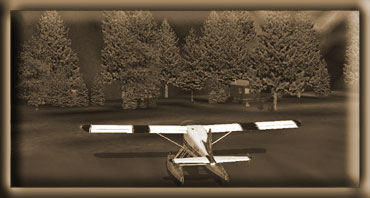
Minimum
ceiling: 2000 feet
Minimum flying altitude: 1700 feet
Minimum visibility: 1 mile
Approximate distance: 24 miles
Direct
from Mountain Point to Cabin: 17 miles at 030
Direct from Cabin to Mountain Point: 17 miles at 210
VFR
Directions: To the Cabins
- After
leaving PAKT or 5KE, position over Pennock Island in the
Tongass Narrows at a heading of 110
- At
the south end of Pennock Island, head toward Bold Island,
Set your heading at 094. Bold Island is 9 miles ahead.
[5.4 minutes]
- At
the south end (far end) of Bold Island, set a heading
for 068 for Cone Point, 3.7 miles ahead. [2 minutes]
- Fly
over Cone Island over Cone Point and change heading to
360 heading for Evo Point, distance 5 miles [3 minutes]
- At
Evo Point, set heading of 008 for Gokachin Lakes, approaching
these, your altitude must be 1700 feet minimum. [4 minutes]
- At
Gokachin Lakes, slightly correct heading for 358. Ella
Lake is 3 miles ahead. Begin dropping altitude and head
for the center of the lake [2 minutes]
- Continue
straight straight ahead to the end of the lake, the cabin
is there.
VFR
Directions: Returning to Ketchikan
- After
leaving either cabin, head for the center of the lake
and begin climbing to 1700 feet. Once at the center of
the lake, select a heading of 178, continue climb to 1700.
- Fly
3 miles to Gokachin Lakes and reset heading for 183 direct
to Cone Point (11.5 miles). [7 minutes]
- At
Cone Point, set a heading of 252 for Bold Island, 3.7
miles [1.5 minutes]
- Over
Bold Island, set a heading of 274 for Pennock Island [5.5
minutes]... you are now in the Tongass Narrows and ATC
should be directing your destination.
Back
to Index
|
|
Hugh
Smith Lake Cabin 
Minimum
ceiling: 2000 feet
Minimum flying altitude: 1500 feet
Minimum visibility: 1 mile
Approximate distance: 55 miles
Direct
from Mountain Point to Cabin: 32 miles at 086
Direct from Cabin to Mountain Point: 32 miles at 267
VFR
Directions: To the Island Cabin
- After
leaving PAKT or 5KE, position over Pennock Island in the
Tongass Narrows at a heading of 110
- At
the south end of Pennock Island, head toward Bold Island,
Set your heading at 094. Bold Island is 9 miles ahead.
[5.5 minutes]
- At
the south end of Bold Island, set a heading for 088 for
Alava Point, the point of land 8.3 miles ahead. [5 minutes]
- At
Alava Point set your heading at 115 for the State Islands
8 miles ahead [4.5 minutes]
- Over
the State Islands, set a heading of 097 for Kah Shakes
Point 3 miles ahead. [1.5 minutes]
- At
Kah Shakes point, set a heading of 029 heading for Orca
Point 6.2 miles ahead. You are flying up the Boca de Quadra
channel [3.5 minutes]
- Orca
Point comes on on your right, and this is where you will
make a right turn to 114 degrees for the tiny Kite Island
in the center of the channel, 3 miles ahead. [1.5 minutes]
- Over
Kite Island, set a heading of 050 heading for Sockeye
Creek that you can see emptying from Hugh Smith Lake,
just beyond. Reduce altitude to 1200 feet to prepare for
landing about 5 miles ahead. [2 minutes]
- As
you come over the shore of Hugh Smith Lake a correction
to your right by 5 degrees and fly down the lake. The
Hugh Smith Cabin is toward the end of the lake on the
right.
VFR
Directions: Returning to Ketchikan
- Taxi
out in front of the cabin and set your heading for about
240 to fly down the lake and take off. Fly the lake to
go over Sockeye Creek.
- As
you come over Sockeye Creek, you should set a heading
for Kite Island, 3 miles ahead at a heading of 230. [1.5
minutes]
- At
Kite Island, turn to 295 heading for Orca Point about
3 miles ahead on the left. At Orca Point you will turn
left.[2 minutes]
- Round
Orca Point and come to a heading of 210 which will take
you to Kah Shakes Point about 6 miles ahead [3.5 minutes]
- At
Shakes Point, you can set a heading of 279 for the small
State Islands.
- At
the State Islands, set a heading of 295 to Alava Point
about 8 miles ahead [4.5 minutes]
- At
Alava Point, set a heading of 269 for Bold Island 8.3
miles ahead. [5 minutes]
- Over
Bold Island, set a heading of 275 for Pennock Island [5.5
minutes] ... you are now in the Tongass Narrows and ATC
should be directing your destination.
Back
to Index
|
|
Humpback
Lake Cabin 
Minimum
ceiling: 2000 feet
Minimum flying altitude: 1500 feet
Minimum visibility: 1 mile
Approximate distance: 55 miles
Direct
from Mountain Point to Cabin: 37 miles at 090
Direct from Cabin to Mountain Point: 37 miles at 270
VFR
Directions: To the Island Cabin
- After
leaving PAKT or 5KE, position over Pennock Island in the
Tongass Narrows at a heading of 110
- At
the south end of Pennock Island, head toward Bold Island,
Set your heading at 094. Bold Island is 9 miles ahead.
[5.5 minutes]
- At
the south end of Bold Island, set a heading for 088 for
Alava Point, the point of land 8.3 miles ahead. [5 minutes]
- At
Alava Point set your heading at 115 for the State Islands
8 miles ahead [4.5 minutes]
- Over
the State Islands, set a heading of 097 for Kah Shakes
Point 3 miles ahead. [1.5 minutes]
- At
Kah Shakes point, set a heading of 029 heading for Orca
Point 6.2 miles ahead. You are flying up the Boca de Quadra
channel [3.5 minutes]
- Orca
Point comes on on your right, and this is where you will
make a right turn to 114 degrees for the tiny Kite Island
in the center of the channel, 3 miles ahead. [1.5 minutes]
- Over
Kite Island, set a heading of 050 to round Grover Point,
the point about 2 miles ahead on your right. You will
see Hugh Smith Lake and Sockeye Creek coming up but you
will turn to starboard before reaching them into Mink
Bay.
- Go
to the right around Grover Point to a heading of 134 ...
this is Mink Bay.
- Toward
the end of Mink Bay, you will see Humpback Creek emptying
into the bay. Turn left at Humpback Creek to a heading
of 064 for about a mile until you reach the edge of Humpback
Lake. Turn to starboard (right) into the lake and follow
it around the "hump". You should begin to reduce
altitude as you will land in 3 miles.
- The
cabin will come up on the left just before the part of
the lakes where the sides constrict ... about 3 miles.
VFR
Directions: Returning to Ketchikan
- Taxi
out in front of the cabin and set your heading for about
220 taking off and flying down the lake. Go around the
humpback (veering left then around to the right) watching
for the end of the lake.
- When
the end of the lake appears, you will see the Humpback
Creek area ... set a heading of 245 to fly back to Mink
Bay.
- Over
Mink Bay, set a heading of 318 to fly up the bay to Grover
Point. You will be going to port (left) around Grover
Point.
- At
Grover point, set a heading for Kite Island, 3 miles ahead
at a heading of 230. [1.5 minutes].
- At
Kite Island, turn to 295 heading for Orca Point about
3 miles ahead on the left. At Orca Point you will turn
left. [1.5 minutes]
- Round
Orca Point and come to a heading of 210 which will take
you to Kah Shakes Point about 6 miles ahead [3.6 minutes]
- At
Shakes Point, you can set a heading of 279 for the small
State Islands.
- At
the State Islands, set a heading of 295 to Alava Point
about 8 miles ahead [4.8 minutes]
- At
Alava Point, set a heading of 269 for Bold Island 8.3
miles ahead. [5 minutes]
- Over
Bold Island, set a heading of 275 for Pennock Island [5.5
minutes] ... you are now in the Tongass Narrows and ATC
should be directing your destination.
Back
to Index
|
|
Kegan
Cove Cabin 
Minimum
ceiling: 1000 feet
Minimum flying altitude: 1000 feet
Minimum visibility: 1 mile
Approximate distance: 55 miles
Direct
from Gravina Point to Cabin: 24 miles at 204
Direct from Cabin to Gravina Point: 24 miles at 024
VFR
Directions: To the Kegan Cove Cabin
- After
leaving PAKT or 5KE, position over the center Pennock
Island in the Tongass Narrows at a heading of 110
- At
the midpoint of Pennock Island, set a heading of 141 to
Gravina Point. This is the point of land at the southern
most tip of Gravina Island (the large island on your right),
about 2.9 miles distant. Prepare for a course correction
to starboard.
- At
Gravina Point, set a heading of 177 for 11 miles to the
Bronaugh Islands. You will turn into Nichols Passage.
The small settlement of China Town is across the passage
to port at the base of Red Mountain. As you make this
turn, Blank Inlet will be on your starboard side.
- As
you are flying down the southern coast of Gravina Island,
you will fly past Bostwick Inlet, and a small cove called
Seal Cove. You will see the Dall Head come up at about
2 o'clock. The Bronaugh Islands are about 2 miles off
the southern coast and should be ahead of you.
- At
the Bronaugh Islands, set a course of 217 for the center
of Moria Sound on the Prince of Wales island. You will
fly over a group of islands at the mouth of the sound,
Whiterock Island will be first, then you will fly over
Menefee Islands. Rip Point will be to port.
- As
you near the entrance of the South Arm (angling off to
your left) you will make a turn to starboard to a heading
of 278. Kegan Lake is ahead of you. The smaller lake before
Kegan Lake is actually Kegan Cove. The cabin is on the
near (south) shore of Kegan Cove. If you are a good pilot,
it is possible to land safely on the cove, otherwise fly
on to Kegan Lake and taxi back to the cabin.
VFR
Directions: Returning to Ketchikan
- Taxi
to the north end of Kegan Lake to give yourself sufficient
room for a safe takeoff. You should set a heading of about
130. Just after you take off, fly over the cabin making
a nice turn to the left out over the water of Moria Sound.
Once in Moria Sound, set a heading for the mouth of the
sound toward Whiterock Island (heading of 040). You will
fly over the Menefee Islands to Whiterock Island just
beyond.
- At
Whiterock Island, set a course of 040 (you already may
be on this heading depending on how you flew to Whiterock
Island). Maintain this heading for 15.9 miles to the Bronaugh
Islands. The Dall Head is the mountain on the south side
of Gravina Island, this is a good visual waypoint to seek.
However, as you get closer, you will see the Bronaugh
Islands, about 10 degrees to starboard. Head for those
islands.
- Over
the Bronaugh Islands, set a course for Gravina Point at
a heading of 357 for 10.5 miles. As you make this turn
to port, the Dall Head is to your left. A small cove coming
up on the left is Seal Cove with a larger inlet just beyond
it which is Bostwick Inlet. The next, and deeper inlet
is Blank Inlet. As You near Gravina Point, you should
be contacting Ketchikan ATC for approach instructions.
- Over
Gravina point, you can set a heading of 332 that will
take you over the center of Pennock Island.
Back
to Index
|
|
Manzanita
Lake Cabin
Minimum
ceiling:2000 feet
Minimum flying altitude: 1700 feet
Minimum visibility: 1 mile
Approximate distance: 33 miles
Direct
from Mountain Point to Cabin: 23 miles at 013
Direct from Cabin to Mountain Point: 23 miles at 193
VFR
Directions: To the cabin
- After
leaving PAKT or 5KE, position over Pennock Island in the
Tongass Narrows at a heading of 110
- At
the south end of Pennock Island, head toward Bold Island,
Set your heading at 094. Bold Island is 9 miles ahead.
[5.5 minutes]
- At
the south end of Bold Island, set a heading for 088 for
Alava Point, the point of land 8.3 miles ahead. [5 minutes]
- At
Alava Point set your heading at 017 for Smeaton Island,
9.6 miles ahead. You will fly over Rudyerd Island during
this leg. At this point, you are in the Behm Canal, a
body of water that circles the Ketchikan Area. [6 minutes]
- At
Smeaton Island, set your heading at 334 for Cactus Point.
This point juts out from the port side of the channel
helping to form Sargents Bay. [7.5 minutes]
- At
the leading edge of Cactus Point turn left to a heading
of 267. You will see Manzanita Lake 5.6 miles ahead. [3
minutes] This lake has to branches, you are lined up on
the branch where the cabin is located. Fly down this branch
and land toward the end of the lake. The cabin is on your
left at the end of the lake.
VFR
Directions: Returning to Ketchikan
- Leave
the lake on a heading of 087 heading for Cactus Point,
about 5 miles ahead. [3 minutes]
- Over
Cactus Point, turn to a heading of 154
for 13 miles. This takes you to Smeaton Island. [7.8 minutes]
- At
Smeaton Island, set a course for Alava Point at a heading
of 199, 12.4 miles ahead. [7.5 minutes]
- At
Alava Point, set a heading of 269 for Bold Island 8.3
miles ahead. [5 minutes]
- Over
Bold Island, set a heading of 275 for Pennock Island [5.5
minutes] ... you are now in the Tongass Narrows and ATC
should be directing your destination.
Back
to Index
|
|
McDonald
Lake Cabin
Minimum
ceiling:2000 feet
Minimum flying altitude: 1500 feet
Minimum visibility: 1 mile
Approximate distance: 50 miles
Direct
from Mountain Point to Cabin: 23 miles at 013
Direct from Cabin to Mountain Point: 23 miles at 193
VFR
Directions: To the cabin
- After
leaving PAKT, position going northwest up the Tongass
Narrows, heading 301 for 2.9 miles to Higgins Point, the
point of land on the right at the mouth of the Tongass
Narrows.
- At
Higgins Point, look about 1 o'clock and you'll see a large
island. This is Betton Island. Set a heading of 347 to
cross over the center of Betton Island. The distance is
about 3.6 miles. As you approach Betton Island, Clover
Passage will be on your right. You are flying up the Behm
Canal (this circles Revillagigedo Island, the island Ketchikan
is on).
- At
Betton Island, set a heading of 337 for 18.2 miles heading
for Snail Point. Pick a point on the horizon and fly to
it as the wind can change your intended heading greatly
on this leg. The island off to your right is Grant Island
with Loring Bay behind it. The point coming up ahead on
the right 8 miles away is Indian Point. To your left you
will see Helm Bay and Helm Point. 15 miles ahead is what
looks like a bay, this is Yes Bay. The point to the left
of that bay is Snail Point.
- At
Snail point, set a heading of 323 for 8 miles to the cabin
on McDonald lake. The lake is tucked behind a low ridge
and you will see it as you draw nearer to the coast. As
you cross the coast, you still have about 5 miles till
you reach the lake. You will cross over the south part
of the lake, then over some land. Look to the base of
the mountain ahead. The cabin is located on a tiny island
on the right side of the lake near the base of the mountain.
VFR
Directions: Returning to Ketchikan
- Leave
the lake on a heading of 143 heading for Snail Point.
You will fly over Spacious Bay with Yes Bay to port.
- At
Snail Point, set a heading of 157, heading for Betton
Island, 18.7 miles distant.
- Over
Betton Island, set a heading for Higgins Point, heading
of 168 for 3 miles.
- At
Higgins point, turn into the Tongass Narrows and head
toward PAKT. (Heading 121)
Back
to Index
|
|
Rainbow
Lake Cabin 
NOTE:
This cabin has a difficult approach. You cannot trust FSNavigator4
because of the final turn. So no FSNavigator4 planning files
have been included for this cabin. This is pure VFR, and
a difficult approach. You must fly between some ridges and
after clearing the last one at 1200 feet, drop quickly to
the surface of the lake for a landing. As you make the final
turn, you should set up for landing configuration and slow
speed.
Minimum
ceiling:2000 feet
Minimum flying altitude: 1200 feet
Minimum visibility: 3 mile
Approximate distance: 15 miles
FSNavigator files NOT INCLUDED with this cabin.
Direct
from Vallemar Point to Cabin: 15 miles at 296
Direct from Cabin to Vallemar Point: 117 miles at 193
VFR
Directions: To the cabin
- Center
over the Tongass Narrows at a heading of about 292. Head
for Vallemar Point, the final land point on Gravina Island
to port.
- From
Vallemar Point, set a heading for 285 which will take
you near the coast of the Cleveland Peninsula. You should
visually head for Caamano Point, the most southern tip
of the peninsula, about 8 miles. Follow the western coastline
of the peninsula for about 10 miles watching VERY closely
for a tiny island named Ship Island Light.
- At
Ship Island Light, you will be making a hard turn to starboard
coming to a heading of 032, flying around the small mountain
to your right. Rainbow Lake is 3.3 miles ahead and not
visible until you are almost upon it. You must maintain
at least 1200 feet to clear the last ridge before you
drop quickly to the lake. Be in landing configuration
just after your turn at Ship Island Light.
- The
Cabin is located on the far side of the lake (eastern
shore).
VFR
Directions: Returning to Ketchikan
- Start
out almost in front of the Rainbow Lake Cabin, and set
a heading of 211.
- Take
off at full throttle to clear the ridge ahead of you.
- Once
you get to the channel, you will see the Ship Island Light.
- At
the Ship Island light, set a heading of about 105 degrees
and follow the western coast south toward Caamano Point.
- At
Caamano Point, set a heading of 110 degrees to fly to
Vallemar Point, the northern point of Gravina Island.
You should be talking to Ketchikan ATC by this point for
approach instructions.
Back
to Index
|
|
Red
Alders Cabin 
Minimum
ceiling: 2000 feet
Minimum flying altitude: 1700 feet
Minimum visibility: 1 mile
Approximate distance: 24 miles
Direct
from Mountain Point to Cabin: 17 miles at 030
Direct from Cabin to Mountain Point: 17 miles at 210
VFR
Directions: To the Cabins
- After
leaving PAKT or 5KE, position over Pennock Island in the
Tongass Narrows at a heading of 110
- At
the south end of Pennock Island, head toward Bold Island,
Set your heading at 094. Bold Island is 9 miles ahead.
[5.5 minutes]
- At
the south end (far end) of Bold Island, set a heading
for 068 for Cone Point, 3.7 miles ahead. [2 minutes]
- Fly
over Cone Island over Cone Point and change heading to
360 heading for Evo Point, distance 5 miles [3 minutes]
- At
Evo Point, set heading of 008 for Gokachin Lakes 6.6 miles,
approaching these, your altitude must be 1700 feet minimum.
[4 minutes]
- At
Gokachin Lakes, slightly correct heading for 358. Ella
Lake is 3 miles ahead. Begin dropping altitude and head
for the center of the lake [2 minutes]
- At
the center of the lake, take the left branch (heading
310) and this cabin is at the end of this branch of the
lake.
VFR
Directions: Returning to Ketchikan
- After
leaving either cabin, head for the center of the lake
and begin climbing to 1700 feet. Once at the center of
the lake, select a heading of 178, continue climb to 1700.
- Fly
3 miles to Gokachin Lakes and reset heading for 183 direct
to Cone Point (11.5 miles). [7 minutes]
- At
Cone Point, set a heading of 252 for Bold Island, 3.7
miles [2 minutes]
- Over
Bold Island, set a heading of 274 for Pennock Island [5.5
minutes]... you are now in the Tongass Narrows and ATC
should be directing your destination.
Back
to Index
|
|
Wilson
Narrows Cabin 
Minimum
ceiling: 2000 feet
Minimum flying altitude: 1700 feet
Minimum visibility: 1 mile
Approximate distance: 44 miles
Direct
from Mountain Point to Cabin: 37 miles at 41
Direct from Cabin to Mountain Point: 37 miles at 221
VFR
Directions: To the Island Cabin
- After
leaving PAKT or 5KE, position over Pennock Island in the
Tongass Narrows at a heading of 110
- At
the south end of Pennock Island, head toward Bold Island,
Set your heading at 094. Bold Island is 9 miles ahead.
[5.5 minutes]
- At
the far end of Bold Island, set a heading for 088 for
Alava Point, this is the point of land 8.3 miles ahead.
[5 minutes]
- At
Alava Point set a heading for Nelson Point 030 which is
11.3 miles ahead up the Behm Canal. [7 minutes]
- At
Nelson Point, we set a heading of 064. You are entering
Smeaton Bay.
- At
a distance of 7 miles [about 4 minutes] , you will see
the Wilson Arm of Smeaton Bay veering off to port (left).
(The Bakewell Arm is straight ahead). Set a heading of
010 for about 6 miles. [3.5 minutes]
- The
Wilson Arm ends where the Wilson River flows into it.
At the Wilson River, set a heading of 330 degrees and
follow the river to Wilson Lake. [3 minutes]
- The
Wilson Narrows Cabin is located near where the Wilson
River leaves Wilson lake. So as you approach the lake,
prepare to land. The cabin will be on your starboard side
as you come over the lake.
VFR
Directions: Returning to Ketchikan
- Take
off from Wilson Lake and fly a heading of 185 (toward
the south end of the lake) about 3 miles.
- At
the south end of the lake, begin following the Wilson
River down to the Thorne Arm of Smeaton Bay, approximately
5 miles. (Approximate heading 150). {3 minutes]
- Turn
right into the Wilson Arm and fly an approximate heading
of 187, making a correction about 3 miles later to 240
heading toward the Behm Canal.
- Fly
to Nelson Point, which is the point to the left of Smeaton
Bay (this channel) and here you enter the Behm Canal.
- At
Nelson Point, set a heading of 210 for Alava Point 11.3
miles ahead. [7 minutes]
- At
Alava Point, set a heading of 267 for Bold Island, 8.1
miles ahead. [5 minutes]
- Over
Bold Island, set a heading of 275 for Pennock Island (8.7
miles) [... you are now in the Tongass Narrows and ATC
should be directing your destination. [5.5 minutes]
Back
to Index
|
|
Wilson
View Cabin 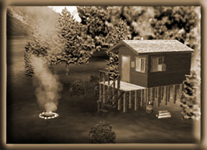
Minimum
ceiling: 2000 feet Minimum flying altitude: 1700 feet
Minimum visibility: 1 mile
Approximate distance: 45 miles
Direct
from Mountain Point to Cabin: 37 miles at 41
Direct from Cabin to Mountain Point: 37 miles at 221
VFR
Directions: To the Island Cabin
- After
leaving PAKT or 5KE, position over Pennock Island in the
Tongass Narrows at a heading of 110
- At
the south end of Pennock Island, head toward Bold Island,
Set your heading at 094. Bold Island is 9 miles ahead.
[5.5 minutes]
- At
the far end of Bold Island, set a heading for 088 for
Alava Point, this is the point of land 8.3 miles ahead.
[5 minutes]
- At
Alava Point set a heading for Nelson Point 030 which is
11.3 miles ahead up the Behm Canal. [7 minutes]
- At
Nelson Point, we set a heading of 064. You are entering
Smeaton Bay.
- At
a distance of 7 miles [about 4 minutes] , you will see
the Wilson Arm of Smeaton Bay veering off to port (left).
(The Bakewell Arm is straight ahead). Set a heading of
010 for about 6 miles. [3.5 minutes]
- The
Wilson Arm ends where the Wilson River flows into it.
At the Wilson River, set a heading of 330 degrees and
follow the river to Wilson Lake. [ 3 minutes]
- The
Wilson View Cabin is located at the far end (north end)
of Wilson Lake. Fly up the lake near the end and you will
find the cabin on your right.
VFR
Directions: Returning to Ketchikan
- Take
off from Wilson Lake and fly a heading of 185 (toward
the south end of the lake) about 3 miles.
- At
the south end of the lake, begin following the Wilson
River down to the Thorne Arm of Smeaton Bay, approximately
5 miles. (Approximate heading 150). [3 minutes]
- Turn
right into the Wilson Arm and fly an approximate heading
of 187, making a correction about 3 miles later to 240
heading toward the Behm Canal.
- Fly
to Nelson Point, which is the point to the left of Smeaton
Bay (this channel) and here you enter the Behm Canal.
- At
Nelson Point, set a heading of 210 for Alava Point 11.3
miles ahead. [7 minutes]
- At
Alava Point, set a heading of 267 for Bold Island, 8.1
miles ahead. [5 minutes]
- Over
Bold Island, set a heading of 275 for Pennock Island (8.7
miles) ... you are now in the Tongass Narrows and ATC
should be directing your destination. [5.5 minutes]
Back
to Index
|
Winstanley
Island Cabin 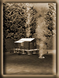
Minimum
ceiling: 2000 feet
Minimum flying altitude: 1700 feet
Minimum visibility: 1 mile
Approximate distance: 45 miles
Direct
from Mountain Point to Cabin: 25 miles at 045
Direct from Cabin to Mountain Point: 25 miles at 226
VFR
Directions: To the Island Cabin
- After
leaving PAKT or 5KE, position over Pennock Island in the
Tongass Narrows at a heading of 110
- At
the south end of Pennock Island, head toward Bold Island,
Set your heading at 094. Bold Island is 9 miles ahead.
[3.6 minutes]
- At
the south end of Bold Island, set a heading for 088 for
Alava Point, the point of land 8.3 miles ahead. [5 minutes]
- At
Alava Point set your heading at 017 for Smeaton Island,
9.6 miles ahead. You will fly over Rudyerd Island on this
leg. At this point, you are in the Behm Canal, a body
of water that circles the Ketchikan Area. [6 minutes]
- At
Smeaton Island, set your heading at 002 for Candle Island.
This is the small island at the southern tip of Winstanley
Island [4 minutes]
- Continue
north over Winstanley Island. Toward the northern tip,
there is a cove on the eastern side. The Cabin is located
on that cove. [5 minutes]
VFR
Directions: Returning to Ketchikan
- Select
a heading for Candle Island (approximately 150 degrees)
- At
Candle Island, set a heading of 182 that takes you over
Smeaton Island, 3.7 miles ahead. [2 minutes]
- At
Smeaton Island, set a course for Alava Point at a heading
of 199, 12.4 miles ahead. [7.5 minutes]
- At
Alava Point, set a heading of 269 for Bold Island 8.3
miles ahead. [5 minutes]
- Over
Bold Island, set a heading of 275 for Pennock Island [5.5
minutes] ... you are now in the Tongass Narrows and ATC
should be directing your destination.
Back
to Index
|
|
Winstanley
Lake Cabin 
Minimum
ceiling:2000 feet
Minimum flying altitude: 1700 feet
Minimum visibility: 1 mile
Approximate distance: 33 miles
Direct
from Mountain Point to Cabin: 25 miles at 045
Direct from Cabin to Mountain Point: 25 miles at 226
VFR
Directions: To the Lake Cabin
- After
leaving PAKT or 5KE, position over Pennock Island in the
Tongass Narrows at a heading of 110
- At
the south end of Pennock Island, head toward Bold Island,
Set your heading at 094. Bold Island is 9 miles ahead.
[5.5 minutes]
- At
the south end of Bold Island, set a heading for 088 for
Alava Point, the point of land 8.3 miles ahead. [5 minutes]
- At
Alava Point set your heading at 017 for Smeaton Island,
9.6 miles ahead. You will fly over Rudyerd Island during
this leg. At this point, you are in the Behm Canal, a
body of water that circles the Ketchikan Area. [5.5 minutes]
- At
Smeaton Island, set your heading at 002 for Candle Island.
This is the small island at the southern tip of Winstanley
Island [3 minutes]
- At
Candle Island, turn right to a heading of 028 ... this
is the heading for Winstanley Lake. There are two lakes
on this bearing, the one you want is the second one 3.1
miles ahead. [2 minutes] Be careful on this approach at
low altitudes, there are 2600 foot features on both sides
of your course.
- As
you are over the lake, you may swing to starboard and
fly toward the cabin which is located on the east side
of the lake.
VFR
Directions: Returning to Ketchikan
- Leave
the lake on a heading of 199 heading for Candle Island,
about 2.7 miles ahead. [1 minutes]
- At
Candle Island, set a heading of 182 that takes you over
Smeaton Island, 3.7 miles ahead. [2 minutes]
- At
Smeaton Island, set a course for Alava Point at a heading
of 199, 12.4 miles ahead. [7.5 minutes]
- At
Alava Point, set a heading of 269 for Bold Island 8.3
miles ahead. [5 minutes]
- Over
Bold Island, set a heading of 275 for Pennock Island [5.5
minutes] ... you are now in the Tongass Narrows and ATC
should be directing your destination.
Back
to Index
|
|
|